MAPPING – Airborne Multi-Sensor Platform
The MAPPING Multi-sensor Platform, completely designed and developed by Geocart, is a system that combines a full waveform laser scanner, one or more high resolution digital cameras and videocameras, a thermal digital camera and two hyperspectral heads operating in VNIR and in SWIR.
The sensors are in their turn all connected to a system combining a GPS and an Inertial Measurement Unit-IMU. The GPS provides the position of the airplane with great precision, while IMU records the data necessary to define the location of the sensors during the flight. In this way it is possible to provide the different outputs coming from the different sensors perfectly overlapping and placed in the same system of reference of coordinates while carrying out the data-processing.
The system that can be installed, according to the application of different models of helicopters and planes, enables us to carry out territorial mapping covering wide surfaces very quickly. To this day, considering the wide range of sensors needed to meet an increasingly growing demand for services based on these technologies, Geocart can simultaneously use two MAPPING platforms on different projects.
The wide range of output that it is possible to produce, makes the system usable for a large number of applications. Accuracy of measures is very high. In order to customise the service offered according to specific client's needs, the platform has been planned to guarantee maximum flexibility and to be used with other sensors.
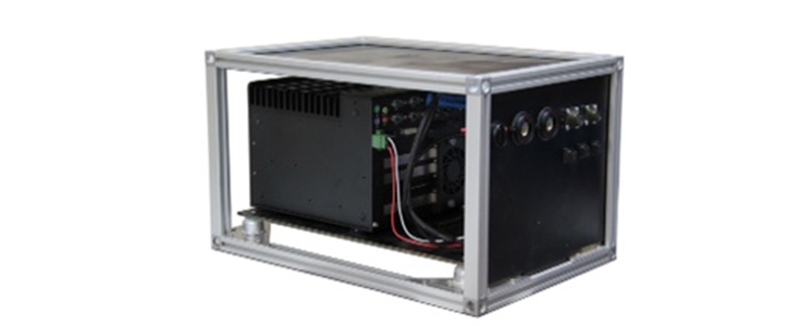
CIRO - Computer Integration for Remote Observation
The system called CIRO (Computer Integration for Remote Observation) is one of the most interesting results achieved by the processes of technological innovation made in Geocart.
It is a multi-sensor platform that can be installed on different kinds of movable vectors such as vehicles, helicopters and railcars, that integrates shooting techniques of digital images and techniques of GPS satellite georeference. Shooting is done by a set of digital cameras or videocameras working in the visible and in the IR; a system of pointing and operation controls the movement of the optical bodies while a system of processing and display ensures the management and storage of the videos and images by correlating them to the exact GPS position of the grip point.
It is a perfect device for the mapping and monitoring of technological networks and linear infrastructures, able to provide the characterization, analysis and control of the investigated elements through aerial or terrestrial inspections.
The supply of GA-Viewer, a software display developed by Geocart, allows the client to navigate in the detected products with functionality similar to those allowed to the operators in charge of the post-processing.
Rail-StreetMapper
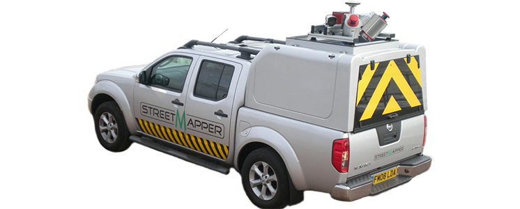
The Rail-StreetMapper was specifically planned for the fast 3D mapping of highways, roads, railways, infrastructures and buildings: a movable vehicle that can be fitted with a series of laser scanners used for 360° mapping of the corridor to be detected with high precision by scanning elements situated up to 330 m away.
Through the acquisition of every detail along the roads and railways including barriers, ditches and overhead power lines, it is possible to reconstruct extremely precise 3D models to design, maintain and assess the load of the power line and carry out post-accident surveys. Furthermore, up to four high resolution digital cameras can be used to capture images and videos.
HyperGEO – Integrated system of hyperspectral sensors
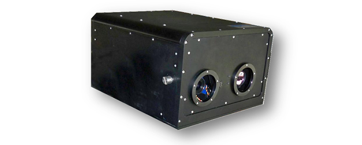
HyperGEO is our hardware and software integrated system of aerial and terrestrial remote sensing for the simultaneous acquisition of hyperspectral data in VNIR and in SWIR.
The two sensor heads are aligned inside a unique device in order to frame the same portion of territory during the inspection. The quality of the images detected when the system is in the air is very high also thanks to the integration of the hyperspectral with the GPS/IMU system.
The spectral range covered by the two sensors used in the system HyperGEO is 400nm – 2500nm.
Penta-DigiCAM
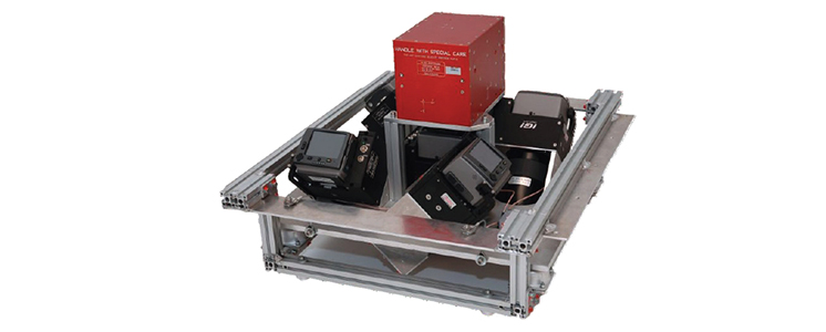
Among our equipment,
Penta-DigiCAM, is the latest generation system for aerial photographic shots of perspective type, allowing the acquisition of simultaneous high resolution images using up to five digital cameras at the same time.
Four oblique cameras combined with a vertical one, all interfaced with the GPS/IMU unit, allow the simultaneous acquisition of oblique and vertical images. Each of the five cameras has a 39 Megapixel resolution.
The system is particularly indicated for 3D City-Modeling and for the mapping of surfaces with raised slopes and vertical structures.