
CITY MODELING
We turn urban spaces into universes to be navigated.
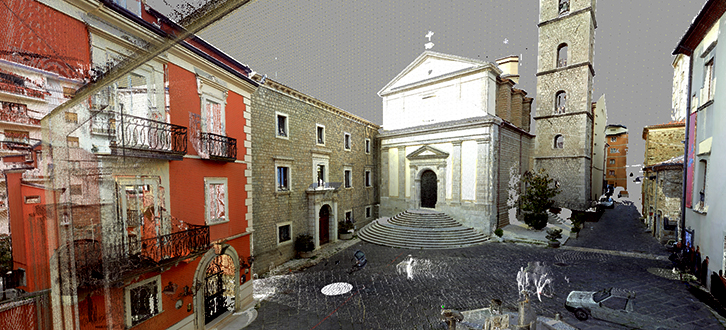
Starting from the detailed information we can capture during laser scans and photographic shots with high-resolution digital cameras, we elaborate digital city models. The city modeling technique which allows us to explore the several levels of information available for a complex object like the urban environment, offers a tridimensional display extremely accurate and realistic of the elements composing the urban landscape, like the surfaces of the soil, buildings, enclosures, infrastructures, vegetation. These models become visual and information spaces fully navigable, result of the integration between the gathered images and the digital building model (DBM).
The great rapidity, the high precision and the ability to put together the colour high resolution digital photography with scanning data make our laser scanners the ideal tools for modeling the cities.
The possible applications of the city modelling range from the urban planning to the study of the traffic, from noise protection to the improvement of citizens' safety conditions.