
SOFTWARE
GEOanalyzer
This device allows the mapping and monitoring of technological networks and linear infrastructures, in addition to natural components.
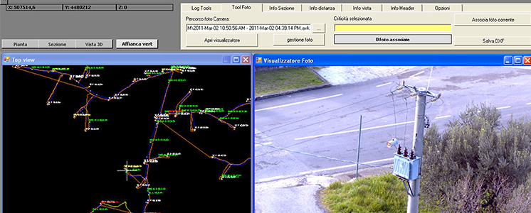
The possibility of installing this system on different kinds of movable vectors, such as vehicles, helicopters or trains is an important feature that makes CIRO system usable for different applications. Through a touch-screen graphic interface, the software allows the operator to record, by a simple click on codified keys, the anomalies observed during the mapping at the end of which a report containing the precise coordinates associated to the different kinds of criticality observed is immediately available.GEOviewer
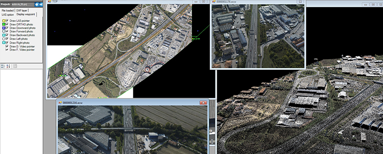
GEOviewer is the software developed by Geocart allowing our clients to display the data acquired by our MAPPING and CIRO remote sensing systems.
GEOviewer allows the display of georefence products through a specific application, clicking on specific points distributed over the different sections into which the detected area is divided. SLIDE
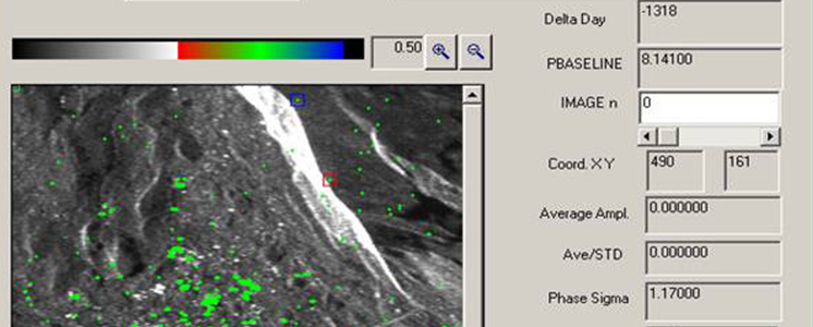
SLIDE - SAR Land Interferometry Data Exploitation - is the software obtained over many years' work, carried out by some of our technicians at the Italian Space Agency site in Matera, within the research on the differential Interferometry techniques on SAR-type radars.