SIMO | Integrated Monitoring System applied on the GAS transport network

SIMO

The "SIMO" project (Integrated Monitoring System: applied to the GAS transport network) has exploited the opportunity offered by a tender of the Italian Space Agency aimed at encouraging SMEs to develop innovative remote sensing services based on the exploitation of new satellite data such as the COSMO-SkyMed constellation data.

The main goal was to set up an alternative Monitoring Service for the methane gas transport network based on the integration of remote sensing data obtained by aircraft and satellite.

The dangers that we wanted to control are, at first , the intrusions of earthmoving machines (excavators, bulldozers, etc.) and then, the gas leaks from underground pipelines generally about 90 cm.
For the detection of vehicles, a new change detection technique has been developed for COSMO-SkyMed data, which is innovative because it allows the quantitative assessment of the probability of a false intrusion alarm.
For the detection of the loss of gas in the subsoil we evaluated with a specific experiment (Prato Experiment) the negative effects that it entails on the vegetation located on the surface. The experiment allowed to measure the stress of the vegetation with a particular processing of the multi-temporal hyperspectral images.

Time Period: 2012 - 2015

Download the project abstract

COSMO-SkyMed | Territory Stability Monitoring

COSMO-SkyMed | Territory Stability Monitoring

The project is in response to a call from the Italian Space Agency, which a few months after the launch of the first COSMO-SkyMed (acronym for COnstellation of small Satellites for the Mediterranean basin Observation) satellite on 8 June 2007, financed the most brilliant projects aimed at demonstrating scientific and civil applications based on the exploitation of innovative Earth Observation (EO) capabilities of COSMO-SkyMed system.
In 2005, Geocart developed a processing procedure and application tool that estimates vertical, slow, and continuous movements with an accuracy of around a few millimeters per year, using Synthetic Aperture Radar (SAR) satellite data with advanced differential interferometry techniques. A natural consequence was a project proposal for ASI, which was primarily aimed at adapting the SLIDE (SAR Land Interferometry Data Exploitation) software to be used with the new COSMO-SkyMed data, and as secondary objectives, implementing an experience of speed-of-displacement detection on certain measurement points such as specially designed and tested artificial reflectors on test sites of interest.

The first stage of the activities was characterized by the development and testing of the SLIDE procedures, modified to use the new COSMO-SkyMed data, considering Maratea and Lagonegro cities in Basilicata along with an area of Rome as testing sites. These locations represented a good testing benchmark as they were previously monitored by Geocart and other research centers to estimate any deformation movements using different SAR satellite data (e.g. ERS-1 and ERS-2).
The second phase was the application of the SLIDE tool adapted to apply COSMO-SkyMed data on the city of Potenza and its surrounding areas, where a network of Artificial Reflectors was tested. The latter was designed in the company and installed on different types of natural and anthropogenic surfaces: different types of soils (e.g. clay, silt, sand), orientation, inclination, and building flat roofs.
The project results included an increase in know-how within the advanced differential interferometry techniques, which produced the new SLIDE suitable for the application of COSMO-SkyMed datasets. In addition, two types of dihedral and trihedron artificial reflectors were designed and tested on a mountainside characterized by a high landslide hazard in Potenza. Last but not least is the operational experience of the monitoring service regarding the territory movements.
Application of SLIDE with COSMO-SkyMed data in comparison with the use of previous SAR data (ERS-1 and ERS-2) allows the vertical movement estimation of land and infrastructures during a shorter period of time more completely and accurately due to the significant increase in the number of natural measuring points applied.

Time Period: 2010-2012

ISTIMES | Integrated System for Transport Infrastructures Surveillance and Monitoring by Electromagnetic Sensing

ISTIMES

The ISTIMES project, funded by the European Union and coordinated by TeRN Technological District with the participation of eight other European partners, provided for the establishment of a complex surveillance and monitoring system for transport infrastructures based on satellite, airborne, and in-situ observation technologies, capable of detecting displacements and dislocations, degradation phenomena, changes in the chemical-physical conditions of the materials, congenital or induced structural defects.

The specificity of the project involved the development of an innovative system for monitoring civil infrastructures of strategic interest, in high natural risk areas, by integrating advanced electromagnetic sensors and information infrastructures for management and data sharing in support of emergency decisions.

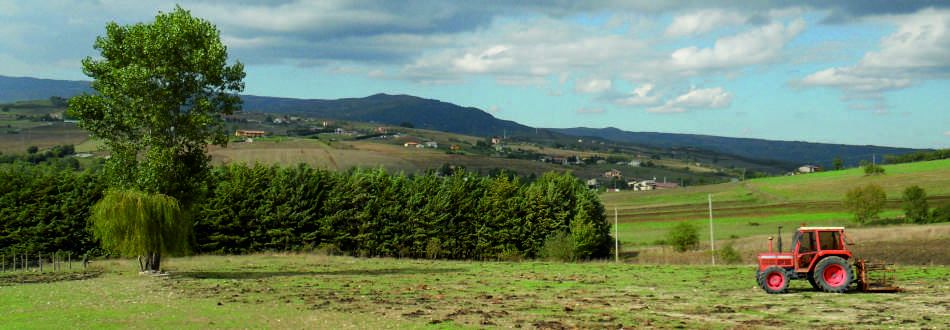
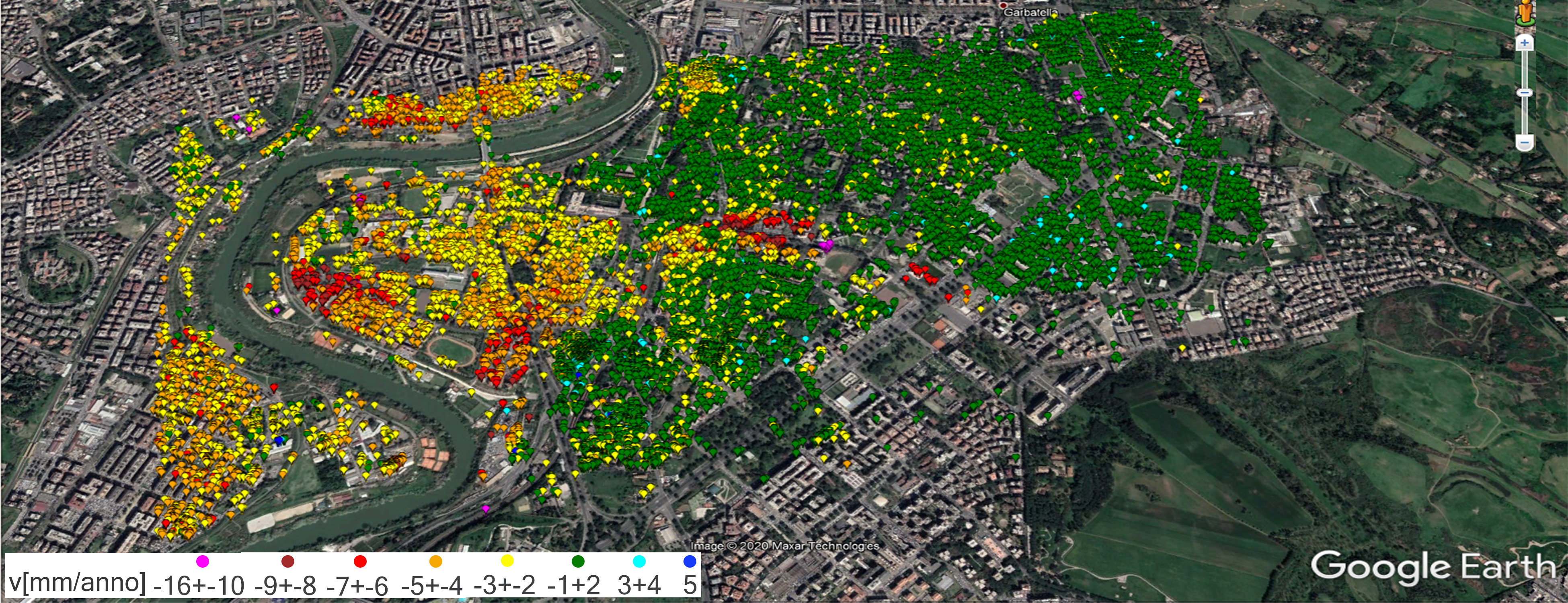
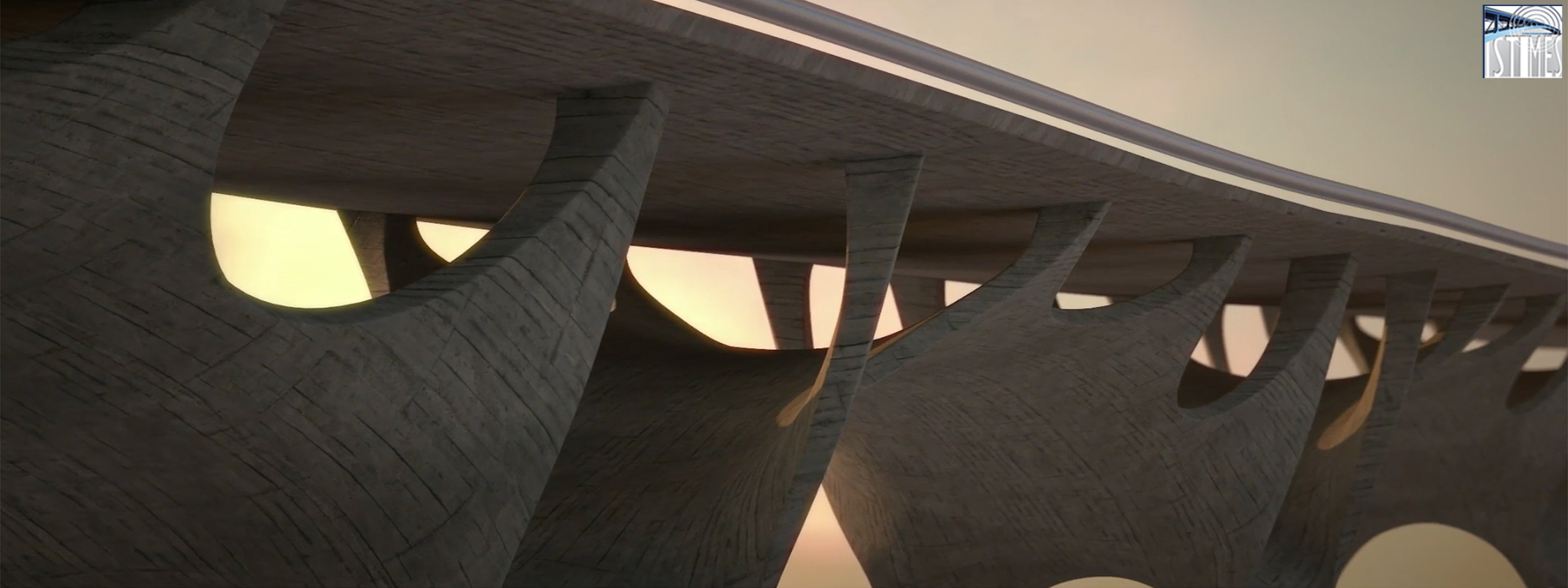
Among the various case studies analyzed in the context of the project, reference is made to the monitoring of two strategic areas characterized by high hydrogeological risk in Basilicata. The first monitored site is located in Varco d'Izzo, where there are numerous landslides near the most important highway section of the region (i.e. SS 407 "Basentana") and the nearby railway. The second site, on the other hand, is a small area of the city of Potenza, which is the "Musmeci Bridge", an important infrastructure connecting the city center to the highway.
The project aimed to identify and define appropriate soil and infrastructure monitoring and characterization techniques that use the overlap of multi-temporal and multi-sensory information.

Geocart, as part of this study, carried out aerial surveys with an integrated multi-sensor platform consisting of a laser scanner, digital and thermal cameras, and a hyperspectral sensor system.
The multi-temporal comparison of DTMs, acquired with lidar technology, has made it possible to highlight the surfaces and volumes affected by landslide movement. Analysis of hyperspectral data, orthophotos, thermal images, and lidar data was beneficial in identifying the characteristics of areas subject to natural risks and in investigations of infrastructure diagnostics.
The project was approved as part of a call for proposals under the 7th Framework Program in the Security and ICT (Information and Communications Technologies) sectors.

Project Partners: TeRN Consortium (Lead Partner), Elsag Datamat S.p.A., Department of Civil Protection and other European partners both public and private in including Lund University - Sweden, Tel Aviv University - Israel, and Laboratoire Central des Ponts et Chaussées (LCPC) - France.

Time Period: 2009 - 2011

This site does not use any cookie profiling.On this website we use only technical cookies.
Cookies are used by third parties related to the presence of "social plugin" , Youtube's video embedded,Google Maps. If you continue browsing, you accept the use of cookies
Should you need further information about the use of cookies on the site and read how to disable the use, please read our extensive information about the use of cookies.