Laser scanner
The sensitivity we have always had in the technological field and the wide diffusion LiDAR is having as a technique for the construction of digital models of the ground, buildings, products, infrastructures and artworks has enabled us to adopt this technology since the beginning for our work, by enlarging the array of sensors that can be installed on a plane or helicopter and, more recently, the tools for very precise terrestrial mapping.
Thanks to the rapidity of execution and precision of the results, in addition to the traditional techniques of aerial and terrestrial photogrammetry, the Laser scanner has become a powerful and reliable tool for advanced topography practices, for the digital tridimensional modelling and for environmental surveys.
The Laser Scanner is based on the physical property the objects have to generate an echo as an answer to the laser impulses that, sent by a source and subsequently gathered by a proper recording system, allow us to investigate the features of interest of the target. It finds application in several fields, from the systems of mapping and support to the engineering and architectural planning, to the environmental monitoring, from the conservation of cultural goods to the advanced production of digital assets for cinematography and gaming.
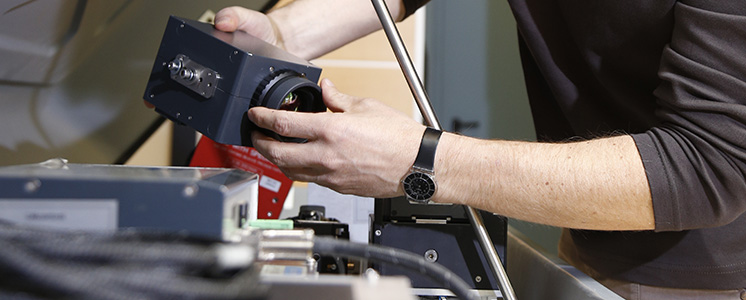
HYPERSPECTRAL SENSORS
The hyperspectral sensors we have allow us to carry out detailed analysis in several fields of application: the forestry-farming field, in order to monitor the state of health of vegetation and the analysis of the farming productivity; in the hydrological field and for the study of coastal environments; in the sector of geological surveys, with the preliminary research of areas of oil interest, in the sector of the environmental monitoring of many of the natural components.
Based on the principle that every element hit by the sunlight has a “spectral signature” by which it radiates part of the energy received, the hyperspectral sensors are used to record this specific feature for all the components present in the area object of inspection. As a result of further data processing phases, it is possible to compare the first recorded hyperspectral signatures with signatures contained in digital libraries or measured as ground truth and to classify the type and identify the status of the elements of interest.
The research is extending the fields of use. Among the typical uses of this technique, we can cite the thermal mapping of the territory, that can be obtained from the analysis of the bands of the infrared and the detection of specific substances or components through the research of the object material.
Our system of sensors operates in VNIR (Visible and Near InfraRed) and in SWIR (Short-Wave InfraRed); it can be used both on aerial vehicles, together with a GPS positioning system and an Inertial System for the georeference of the produced images, and for ground acquisitions.
DIGITAL CAMERAS
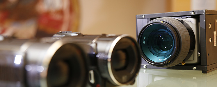
The remarkable experience gained and the extent of applications developed over the years, place us among the best companies operating in this sector, thanks to the high quality standards we guarantee on our products, derived from the use of high resolution digital cameras.
The aerial images are elaborated in our post-processing laboratories and, with the aid of the DTM of the detected areas, we develop orthophotos that can achieve ground sample distances of very few centimetres. The same orthophotos are used to obtain products derived from the vectorization of the elements of interest and for the realization of technical cartography.
On the basis of the traditional stereoscopy principles, supported by the availability of very performing software solutions, the use of adjacent frames portraying the same objects filmed from two different perspectives, allows us to have a digital stereoscopic vision from which it is possible to get the information necessary to extract tridimensional vectorial models and/or point cloud.
Furthermore, we have the Penta-DigiCAM, a modular solution that allows the simultaneous use from two to five digital cameras particularly suitable for the acquisition of oblique images, whose use is becoming more and more common for the 3D City-Modeling.
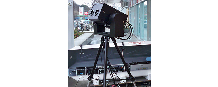
THERMAL CAMERAS
The latest generation thermal cameras we have available, allow us to obtain the thermal mapping of surfaces and objects. The point of strength of the models we have at present is the versatility of use that makes this tool suitable for both aerial and terrestrial shots.
This tool usually used with other sensors in our MAPPING and CIRO aerial platforms, gathers the radiation emitted in the band of the near infrared, converting it into a false colour image with customised scales and allowances.
The thermal camera, a non-invasive and secure device for human health, can be applied to several fields, such as environmental monitoring, the test of civil and industrial works and products, the detection of anomalies in the functionality of technological networks and infrastructures, the monitoring of the coastal waters and the search for thermal anomalies along the power lines.
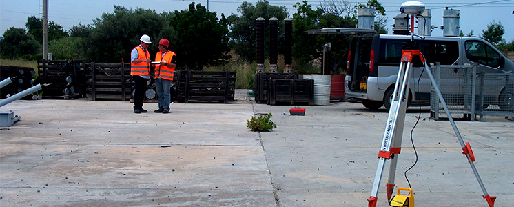
GPS AND TOPOGRAPHIC TOOLS
The devices and the applications our teams of topographers daily work with, both for the operations of on-site inspections and for the following phases of data processing, are characterized by high levels of accuracy and reliability.
Together with the wide range of GPS, optic-electronic topographic tools, such as for example the total stations of Nikon and Leica with Pin Point laser system, allow very accurate measuring. We supply a set of tools including a wide range of equipment necessary to carry out topographic mapping.
In our site, a GPS Permanent Station has been installed, functioning in continuous acquisition 24 hours a day since 1998, the data of which are available on request for any external user. Rigid tests of calibration and other tests and checks are periodically carried out.