OT4CLIMA | Innovative Earth Observation (EO) technologies to study Climate Change and its impact on environment and territory
The overall objective of the OT4CLIMA project, funded by MIUR under the PON Research and Innovation Program 2014 and 2020 - PNR 2015-2020 - "Aerospace" Specialization Area, is to develop new measurement tools and new Earth Observation methodologies to provide products/applications/services aimed at improving mitigation capabilities of the effects of Climate Change (CC) at regional and sub-regional scale.
The project is based on the awareness that the environmental and territorial impacts of the ongoing CCs need to be better understood, modeled and observed, even at the local and regional scales in order to implement appropriate and effective mitigation strategies. It responds to some of the outstanding challenges identified by major international initiatives (e.g. CEOS WG Climate, GCOS) as Recommendations and Actions for the coming years, such as the use of new observation technologies, observation of additional climatic parameters as well as the development of new analysis techniques (cf. GCOS 2016 Implementation Plan).
OT4CLIMA, without claiming to address the problem as a whole, intends to contribute to specific phenomenological areas (water and carbon cycle), parameters, observables, and environmental matrices.
Specifically, both medium- and long-term impacts (e.g. vegetation stress, drought) and extreme events with rapid evolutionary dynamics (e.g. intense weather conditions, fires) will be investigated in an attempt to achieve dual technological, "product" and "process" innovation.
The project, for instance, will make concrete the possibility to measure, in an unprecedented manner and accuracy, both atmospheric parameters (e.g. Carbonyl sulfide (COS)) and surface parameters (e.g. soil water content) essential in determining the vegetation contribution to the CO2 balance, while proposing solutions based on analysis and integration of observation data acquired by satellite, airborne, and unmanned platforms to significantly improve the ability of local communities to address the effects of CCs in short- and long-term.
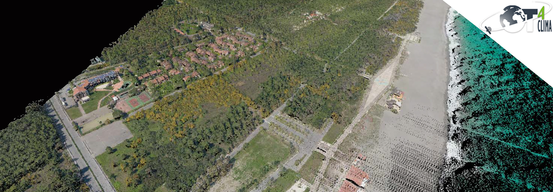
Particularly, within the framework of the realized objective of advanced EO methods for the study of short-term climatic impacts as well as quantitative characterization of fires, Geocart is working on research and development of methodologies that are as automated as possible and, based on application of lidar data, for the estimation of available pre-event biomasses. The study area is the Ionian coast of Lucania, where Geocart has a database of lidar and optical multi-temporal data acquired with airborne platforms.
The project team consists of a solid public-private partnership with a strong presence in the European and national research and innovation system in the Aerospace sector.
Project Partners: National Research Council (Lead Partner), CREATEC Scarl, SIIT S.c.p.a. Technological Integrated Intelligent Systems, University of TRENTO, Italian Space Agency, SURVEY LAB S.r.l., CO.RI.S.T.A. - Research COnsortium on Advanced Telesensor Systems, National Institute of Geophysics and Volcanology, University of CALABRIA, e-GEOS S.p.A., I.D.S. - SYSTEM ENGINEERING S.p.A., University of BASILICATA (UNIBAS), CIRA S.c.p.A. - Italian Aerospace Research Center.
Time Period: 2018 - 2021