
COSMO-SkyMed | Territory Stability Monitoring
The project is in response to a call from the Italian Space Agency, which a few months after the launch of the first COSMO-SkyMed (acronym for COnstellation of small Satellites for the Mediterranean basin Observation) satellite on 8 June 2007, financed the most brilliant projects aimed at demonstrating scientific and civil applications based on the exploitation of innovative Earth Observation (EO) capabilities of COSMO-SkyMed system. In 2005, Geocart developed a processing procedure and application tool that estimates vertical, slow, and continuous movements with an accuracy of around a few millimeters per year, using Synthetic Aperture Radar (SAR) satellite data with advanced differential interferometry techniques. A natural consequence was a project proposal for ASI, which was primarily aimed at adapting the SLIDE (SAR Land Interferometry Data Exploitation) software to be used with the new COSMO-SkyMed data, and as secondary objectives, implementing an experience of speed-of-displacement detection on certain measurement points such as specially designed and tested artificial reflectors on test sites of interest.
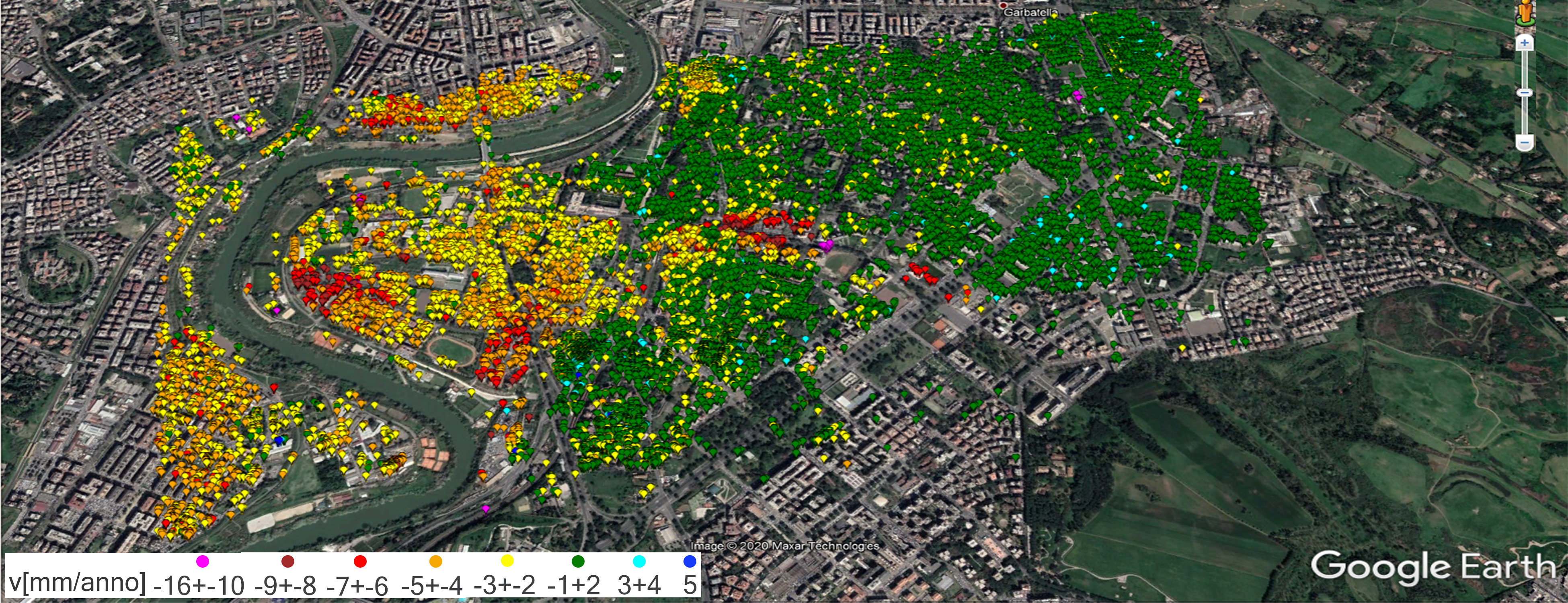
The first stage of the activities was characterized by the development and testing of the SLIDE procedures, modified to use the new COSMO-SkyMed data, considering Maratea and Lagonegro cities in Basilicata along with an area of Rome as testing sites. These locations represented a good testing benchmark as they were previously monitored by Geocart and other research centers to estimate any deformation movements using different SAR satellite data (e.g. ERS-1 and ERS-2). The second phase was the application of the SLIDE tool adapted to apply COSMO-SkyMed data on the city of Potenza and its surrounding areas, where a network of Artificial Reflectors was tested. The latter was designed in the company and installed on different types of natural and anthropogenic surfaces: different types of soils (e.g. clay, silt, sand), orientation, inclination, and building flat roofs. The project results included an increase in know-how within the advanced differential interferometry techniques, which produced the new SLIDE suitable for the application of COSMO-SkyMed datasets. In addition, two types of dihedral and trihedron artificial reflectors were designed and tested on a mountainside characterized by a high landslide hazard in Potenza. Last but not least is the operational experience of the monitoring service regarding the territory movements. Application of SLIDE with COSMO-SkyMed data in comparison with the use of previous SAR data (ERS-1 and ERS-2) allows the vertical movement estimation of land and infrastructures during a shorter period of time more completely and accurately due to the significant increase in the number of natural measuring points applied.
Time Period: 2010-2012